Map Musings


|
|
45°35'34.4"N 95°52'51.4"W :
|
The Map Pin Project
This project challenges the scientific ideas and practices of cartography and how this mode of mapping represents geography in accurate and inaccurate ways. I have found that maps, in Western practice, are often empirical and analytical versus relational and personal. Western map practice originated for imperial necessity and was used as tools of colonization and expansion. This history has given maps a political, colonial charge. In the age of google maps, we use maps daily but think little of them or of the ways they represent the land. This project aims to reject notions of mathematical, "true" geography as well as the priorities of a singular cartographer. These simple map pins serve as tools for participants to create various interactive and tactile maps that represent the places that are significant to them and in abstract spatial relationships more akin to the maps in our brains. This project also aims to aid participants in exercising their spatial and directional senses as well as foster conversation and thinking about the names of geographic markers and their own relationship to place.
Trial One - December 4th 2019, Wednesday
In the first trial of The Map Pin Project was performed with fresh snow in a large clearing north of the Humanities and Fine Arts Building on the University of Minnesota, Morris campus. The 8 present participants were comprised of my sculpture class including myself. Responses were varied with many geographic and spatial relationships between points considered and plotted accordingly by participants. Some responses were less geographic and more temporal. The coordinates of the pins were plotted with distances and angles from the center pin analog style.
Ages
18-30: 5
30-50: 1
50-70: 2
Pin Responses
Blue pin: Here, Morris, MN, HFA, Today, December 4th 2019, Wednesday.
Ages
18-30: 5
30-50: 1
50-70: 2
Pin Responses
Blue pin: Here, Morris, MN, HFA, Today, December 4th 2019, Wednesday.
- Bump City
- Memories/ Florence St. Ives, TSM, NFM, Budapest, Childhood
- *Cat drawing*
- Glenwood MN
- Alex MN
- My Brother (flip) My Sister
- Zoë
- Fireplace @ Zak’s house
- Comfort Safety Security
- Ceder Lake
- Ceramics Studio (home)
- Minneapolis Airport (place of my first date)
- Graduation
- Mother
- Indiana
- Melborne Florida
- Florida
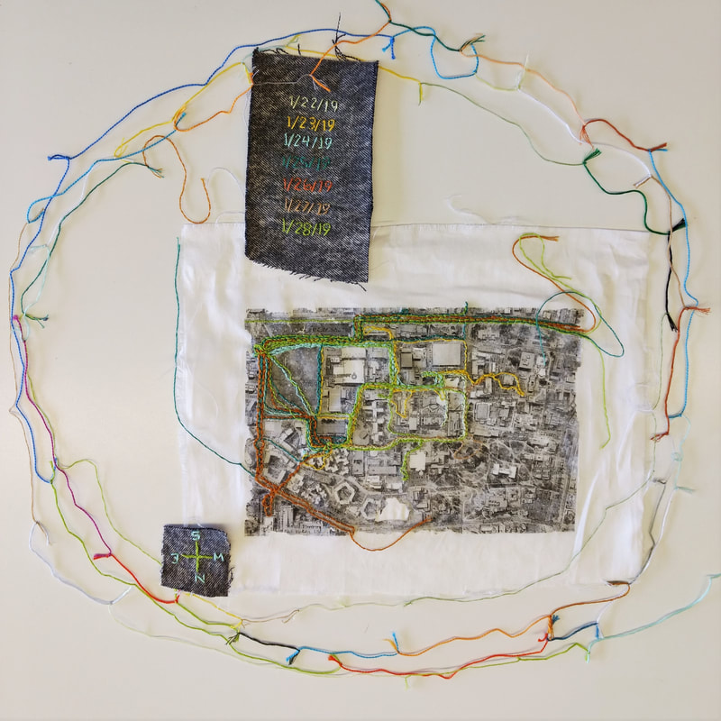
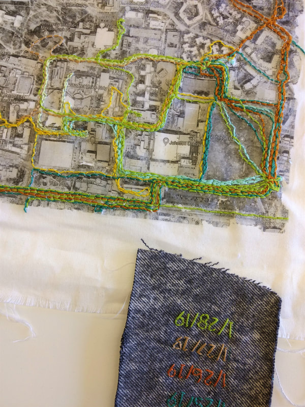
Trial 2 - March 8th, 2020, Sunday
The second performance of this piece was occurred on the Campus mall at the University of Minnesota, Morris. Participants were gathered via request as well as passerby recruitment. 7 people including myself participated in this map making, all of which were college students within the age range of 18-30 years old. The process began with the asking of these four questions:
Pin Responses:
Blue pin: Stolen Land/3 eagles circling above
3. The field behind my childhood home *included a sketch of the field*
4. What is this grass?
5. Just Be
6. Discarded things, trash harming the land
7. wetland prairie
8. a place of wind
9. community, school, waiting, learning, letting go, seeking, stuck, students, growth, sadness, angst
10. lead plant, echinacea, nettle, dandelion, mullein, tobacco, yarro, sage, Big Bluegrass
11. Trauma
12. what is it you plan to do with your one wild precious life?
13. we don't own this land
14. this is a lamp, rampu
15. this is trash/this is plastic
16. today is Sunday that's what they say
17. My past and present self was here/this should be used more
19. three yrs ago I sat here and read the art of courtly love
20. This place restricts the use of personal + spiritual exploration __ organic + synthetic Psychedelic/entheogenic plants, fungi, + other molecules
- How do you know where you are?
- What things appear on maps?
- Who named the things where you are and on maps?
- do they represent things that are important to you?
Pin Responses:
Blue pin: Stolen Land/3 eagles circling above
3. The field behind my childhood home *included a sketch of the field*
4. What is this grass?
5. Just Be
6. Discarded things, trash harming the land
7. wetland prairie
8. a place of wind
9. community, school, waiting, learning, letting go, seeking, stuck, students, growth, sadness, angst
10. lead plant, echinacea, nettle, dandelion, mullein, tobacco, yarro, sage, Big Bluegrass
11. Trauma
12. what is it you plan to do with your one wild precious life?
13. we don't own this land
14. this is a lamp, rampu
15. this is trash/this is plastic
16. today is Sunday that's what they say
17. My past and present self was here/this should be used more
19. three yrs ago I sat here and read the art of courtly love
20. This place restricts the use of personal + spiritual exploration __ organic + synthetic Psychedelic/entheogenic plants, fungi, + other molecules
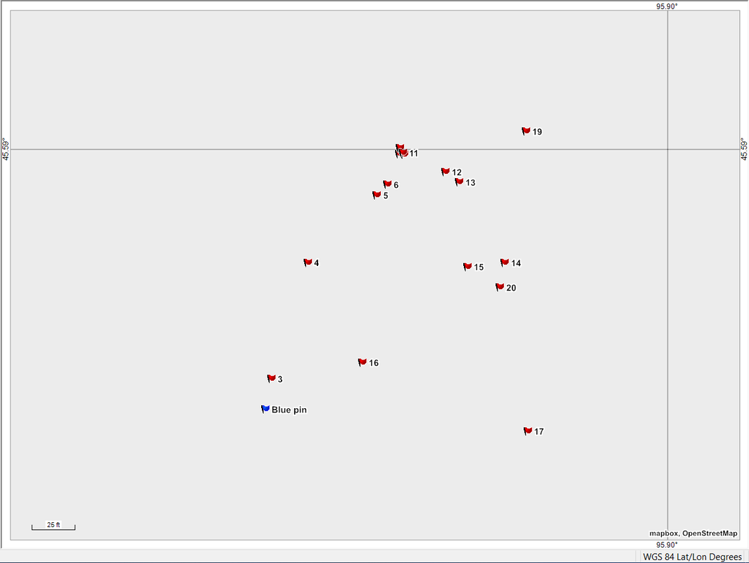
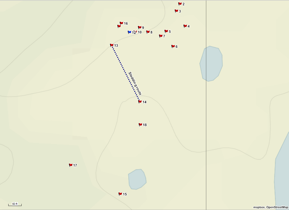
Mapping Home Politics and Change
This mapping was created by myself as I reflected on the changes in and politics of the land I grew up on. This 16 acres of land is a microcosm of border politics and an anecdote of transformation in the landscape. This mapping was intended to label the land in the terms of these conflicts and the transformations. This mapping attempts to expose the layers of memories I have in this space and landscape as a result of border conflicts and physical transformations of features.
2. This used to be flat 1258.03 ft
3. The garden used to be here 1254.09 ft
4. This shed was built to block that shed 1217.82 ft
5. These trees used to not be here 1234.38 ft
6. My chicken coop used to be here/now there is a cattle shelter here
7. Lake George swan house/Dad's Goose House/my playhouse/mom's garden shed
8. this was the first tree I climbed 1247.78 ft
9. Before, this was my sandbox 1261.19 ft
10. There was a tree here too 1258.03 ft
11. There was a tree here 1261.98 ft
12. Blue pin: HOME: March 16th 2020 1258.82 ft
13. Sledding start here 1254.09 ft
14. Sledding end here 1210.73 ft
15. The most politically charged opening 1221.77 ft
16. This corner is the source of many fights (Elevation unknown)
17. Dead man's hill 1239.90 ft